


Precinct WASHINGTON-NORTH, Pickaway County, Ohio
About
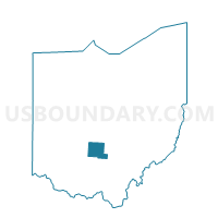
Outline

Summary
| Unique Area Identifier | 650980 |
| Name | Precinct WASHINGTON-NORTH |
| County | Pickaway County |
| State | Ohio |
| Area (square miles) | 8.39 |
| Land Area (square miles) | 8.05 |
| Water Area (square miles) | 0.33 |
| % of Land Area | 96.03 |
| % of Water Area | 3.97 |
| Latitude of the Internal Point | 39.63853960 |
| Longtitude of the Internal Point | -82.88408680 |
Maps


Graphs
Select a template below for downloading or customizing gragh for Precinct WASHINGTON-NORTH, Pickaway County, Ohio


Neighbors
Neighoring Voting District (by Name) Neighboring Voting District on the Map
- Voting District AMANDA B, Fairfield County, OH
- Voting District CLEARCREEK A, Fairfield County, OH
- PRECINCT CIRCLEVILLE 1-B, Pickaway County, OH
- PRECINCT CIRCLEVILLE-NORTH, Pickaway County, OH
- Precinct WALNUT-EAST, Pickaway County, OH
- Precinct WALNUT-WEST, Pickaway County, OH
- Precinct WASHINGTON-CENTRAL, Pickaway County, OH
Top 10 Neighboring County Subdivision (by Population) Neighboring County Subdivision on the Map
- Circleville city, Pickaway County, OH (13,314)
- Clearcreek township, Fairfield County, OH (4,057)
- Washington township, Pickaway County, OH (3,151)
- Walnut township, Pickaway County, OH (2,809)
- Amanda township, Fairfield County, OH (2,706)
- Circleville township, Pickaway County, OH (2,389)
Top 10 Neighboring Place (by Population) Neighboring Place on the Map
Top 10 Neighboring Unified School District (by Population) Neighboring Unified School District on the Map
- Teays Valley Local School District, OH (22,621)
- Circleville City School District, OH (14,937)
- Logan Elm Local School District, OH (13,175)
- Amanda-Clearcreek Local School District, OH (8,434)
Top 10 Neighboring State Legislative District Lower Chamber (by Population) Neighboring State Legislative District Lower Chamber on the Map
- State House District 5, OH (146,156)
- State House District 91, OH (130,644)
- State House District 85, OH (125,655)
Top 10 Neighboring State Legislative District Upper Chamber (by Population) Neighboring State Legislative District Upper Chamber on the Map
Top 10 Neighboring 111th Congressional District (by Population) Neighboring 111th Congressional District on the Map
Top 10 Neighboring Census Tract (by Population) Neighboring Census Tract on the Map
- Census Tract 211, Pickaway County, OH (7,559)
- Census Tract 326, Fairfield County, OH (6,763)
- Census Tract 203.20, Pickaway County, OH (3,447)